You know you’re getting close to Usery Mountain Regional Park when you see the enormous white Phoenix directional sign painted on the side of the mountain. Then when you hear continual gun-fire, make a right and you’re there.

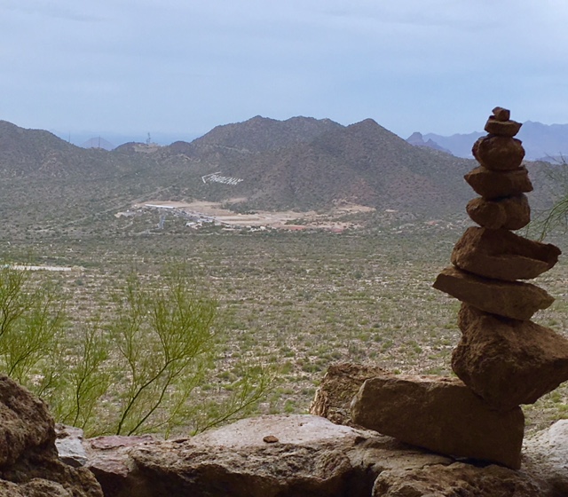
Compared to McDowell (reviewed in Part 1), the sites at Usery were small and closely spaced. The above mentioned heavily used gun range is only a few miles from the park and made it sound like we were near a 24/7 construction zone. The campground looks down over the city and, although the pollution was too thick to see the mountains on the far side of Phoenix, at sunset with the twinkling city lights it was a very pretty view. It is under the flight path of the outbound airplanes at Sky Harbor so as we sat outside for cocktail hour every night we watched the lights of the jets, one after another after another, pass over us at about 10,000 feet.
The trail system isn’t as extensive as McDowell’s and you can’t access it from the campground. You have to ride on the park road for a little over a mile to get to the trails. This road also goes to one of the most popular hikes in Phoenix – Wind Cave – so the traffic, especially on the weekend, is non-stop. Once on the trails, the mountain biking is a lot of fun. I didn’t enjoy it as much as McDowell, not quite sure why. But I did giggle a few times and let loose at least one ”whoo-hoo”.
I didn’t do any trail running though. (I just couldn’t make myself run a mile each way on busy pavement to get to the trails.) But I did hike to Wind Cave. The steep, rocky trail got my heart rate up and the trip down gave my knees a workout. The views were beautiful, but the end was anti-climactic. With the name of Wind Cave Trail, I kinda expected to see a cave, maybe even with wind coming out of it. But it is just an overhang with some cool bee hives built into the porous cliff.
The trail to Wind Cave is pretty easy to follow. With so many people hiking it every day, when the markings are hard to find, you just have to look at which rocks have the most wear. But as I was hiking it, I did think to myself that it would be a little difficult in the dark (the park stays open until 10:00 pm). And then, sure enough, one night at around 8 pm, we watched the red and blue lights of emergency vehicles wind along the park road to the parking lot of the trail. Soon after we heard a helicopter beating its way to the mountain. For the next hour or so, the helicopter lit up the side of the mountain with its super bright search beacon. At the same time, Mitch and I watched a tiny little light blinking on and off further above it. We thought, “Surely they see that flashlight, right?” Then we thought, “Well, that must be one of the searchers.” A while later the flashlight was in the same spot and we thought, “Maybe we should call someone and let them know about that flashlight.” I tried calling all the after hours park numbers with no luck. Finally, the helicopter honed in on the flashlight and plucked two hikers off the mountain.

Mitch enjoyed the road biking opportunities near the park because most of the roads had ample shoulders. His first ride nearly killed him though. He headed out of the park, turned right on Usery Pass Road (the name of the road should have been enough of a warning), had a short section of up before the long downhill started. It is impossible to thoroughly enjoy a great downhill when you know you have to go back up it. It took him 5 minutes to get down and an hour to get back up.
Saguaro Lake is only about 15 miles from Usery. I’d read about a hiking trail there that sounded like it would be a trail run I could handle – only 300 feet of elevation gain. So we combined a one-way bike ride for Mitch with a trail run for me. I drove The Whole Enchilada (our nick-name for our truck/camper combo) to the trail head at the Butcher Jones Recreation Area and Mitch rode his bike from the campground so he could enjoy that nice long downhill properly.

The Butcher Jones trail started out following the contours of the lake. Seeing the combination of desert and water will never become routine for me. Simply beautiful. Then it cut over the headland and branched off in a few places. It was all well-marked until the end (I think it was the end anyway). I thought I was going to Burro Cove which was supposed to be a great swimming and fishing area. But the trail I was on ended in a tangle of tamarisk with a couple of campfire rings. An anti-climactic end, again, but the views there and back were well worth it.


The Butcher Jones trail had an easy rating. And I guess in the realm of trails “out west” it was. However, my lungs might disagree. On a couple of the uphill sections I was over-joyed to see hikers coming my way. I had to stop running and step to the side of the trail to let them pass. It was only the polite thing to do!
Next stop, Lost Dutchman State Park!